


Near Iran’s Kharg Island export hub: Suspected oil spill seen on satellite images
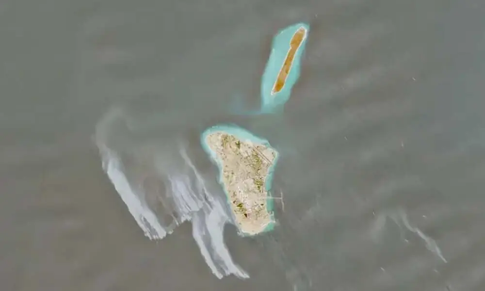

LONDON: A suspected oil spill covering dozens of square kilometres of sea near Iran’s main oil hub of Kharg Island has been seen on satellite imagery this week.
The likely spill - appearing on images as a grey and white slick - covered waters to the west of the 8-kilometre (5-mile) long island, pictures from Copernicus’s Sentinel-1, Sentinel-2 and Sentinel-3 satellites showed on May 6-8.
“The slick appears visually consistent with oil,” said Leon Moreland, researcher at the Conflict and Environment Observatory, who estimated that it was covering an area of approximately 45 square km. Louis Goddard, co-founder of consultancy Data Desk, which focuses on climate and commodities, agreed that the images likely showed an oil slick, which he said was potentially the largest to occur since the start of the US-Israel war against Iran 70 days ago.
The US military and Iran’s mission to the United Nations in Geneva did not immediately respond to requests for comment on the images.
The cause of the possible spill and the point of origin are currently unknown, Moreland added, noting that images from May 8 showed no evidence of additional active spills.
Kharg Island, where US forces said they had destroyed military targets earlier in the war, is the hub for 90% of Iran’s oil exports, much of which is bound for China. The US Navy has been blockading Iran’s ports in an attempt to stop Tehran’s tankers from entering and exiting, while US and Iranian forces have clashed in the Gulf.






















Comments