


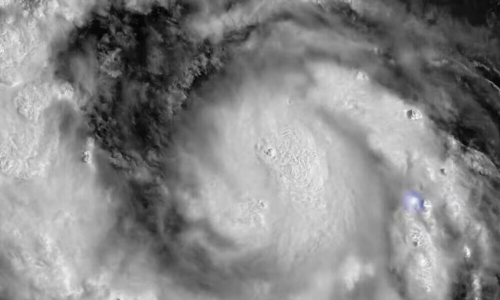

Erin, the first hurricane of the 2025 Atlantic season, has been downgraded to Category 3, the US National Hurricane Center said early on Sunday, as the storm’s wind speed eased slightly.
The hurricane was about 330 miles (530 km) east-southeast of Grand Turk Island packing maximum sustained winds of 125 mph (205 kph).
It had been gauged as high as a catastrophic Category 5 with maximum sustained winds of 160 mph (240 kph), then downgraded to a Category 4.
It had earlier been forecast to strengthen into this week.
The meteorological services of France and the Netherlands discontinued tropical storm watches for St. Martin, St. Barthelemy and Sint Maarten, the NHC said.
On Sunday, Erin was moving west-northwest at nearly 14 mph (22 kph) with a decrease in forward speed expected on Sunday and a turn to the north on Monday and Tuesday, the NHC said.
Erin was forecast to pass to the east of the Turks and Caicos islands and the southeastern Bahamas on Sunday night and Monday.
Swells generated by Erin will continue to affect parts of the northern Leeward Islands, the Virgin Islands, Puerto Rico, Hispaniola and the Turks and Caicos Islands for the next couple of days, the NHC said.
These swells will spread to the Bahamas, Bermuda, the east coast of the United States, and Atlantic Canada during the early and middle portions of the week.
Rough ocean conditions will likely cause life-threatening surf and rip currents, the NHC said.
The Bahamas, which provides some meteorological services for the Turks and Caicos Islands, issued a Tropical Storm Watch for the British islands to its southeast.
Erin has also raised concerns about wildfire risks if human-caused sparks ignite parched vegetation and strong dry winds fan the flames.
BMS Group Senior Meteorologist Andrew Siffert said these conditions could arise if Erin grows into a powerful offshore storm fueled by colliding warm and cold air rather than tropical seas.
Insurance-linked securities manager Twelve Securis said on Friday that Erin was forecast to remain far enough offshore to spare the US East Coast from significant impacts.





















Comments
Comments are closed for this article.